Aloha! Greetings from the Hawaii of Europe: the Portuguese island of Madeira, known as the birthplace of CR7, but above all as the ultimate hiking island. The mild climate, the exotic flowers and the rugged, mountainous landscape make Madeira a gem for adventurous hikers. And we like to count ourselves among them! In November 2020 we racked up plenty of miles on Madeira and crowned four trails as our favorites. On top of that, we share six more popular hikes. Heads-up: since 2026 you have to book and pay in advance for the official trails. Read on to find out how that works.
Hiking in Madeira
Madeira’s unique nature
Madeira is known for its unique natural beauty. From lush green landscapes to towering cliffs rising above the azure sea, Madeira has it all. What really makes this island special are the levadas: historic irrigation channels, built since the 15th century, that wind through the mountains and valleys. Together they stretch some 2,000 to 3,000 km, and many of them are lined with a narrow maintenance path that now doubles as a hiking trail. These routes take you on an adventure through ancient laurel forests (a UNESCO World Heritage Site since 1999), past breathtaking waterfalls and to hidden lagoons.

Best time to hike in Madeira
You can hike in Madeira all year round. Even in winter, daytime temperatures in Funchal reach about 20°C (68°F), and 25 to 27°C (77 to 81°F) in summer. The driest months are April to October. High up in the mountains it’s a lot cooler, though: in winter it can freeze or snow on the peaks, and the road to Pico do Areeiro sometimes closes. In summer, trails close temporarily when there’s a risk of wildfire. Always pack a rain jacket. A shower is never out of the question and the weather on the island can change quickly. Heading higher into the mountains? Then a warm sweater and a windbreaker are no luxury! More details (in Dutch) on klimaatinfo.nl.
Booking and fees (2026)
Since January 1, 2026, you have to book a time slot and pay in advance for every official hiking trail in Madeira. That applies to all routes with a PR number, including the hikes we describe below. You do this online through the government portal SIMplifica. You pick the route, the date and a start time, and you have to set off on the trail within that half hour. Show your digital ticket if the rangers ask for it. Without a ticket you risk a €50 fine.
- €4.50 per person per route per day
- €10.50 for the full PR1 from Pico do Areeiro to Pico Ruivo (only to the Pedra Rija viewpoint and back: €4.50)
- Several routes: €9 per day, €22.50 for 3 days or €52.50 for 7 days (not valid for the PR1). You still book each route separately; SIMplifica automatically charges the cheapest rate.
- Children aged 12 and under hike for free, but you do have to include them in your booking.
Book early, especially for sunrise on Pico do Areeiro: popular time slots fill up fast. You won’t get a refund for bad weather, only if the forestry service (IFCN) closes the trail itself. So check the current status on the IFCN website the day before your hike.
Levadas without a PR number, such as the Levada dos Tornos above Funchal, are still free and open to everyone. You’ll find a few of them further down in this article.
Don’t feel like dealing with the booking hassle? If you hike with a licensed guide, you pay a lower fee (€3, or €7 for the full PR1) and the organizer books your time slot. For the PR1, a transfer is extra handy: you get dropped off at Pico do Areeiro and picked up at Achada do Teixeira. Have a look at this sunrise transfer to the PR1 or this guided hike to 25 Fontes. With transfers without a guide you often still have to buy your own ticket, so check what’s included.
Getting there and parking
Most trailheads are high up in the mountains or at the end of a narrow road. A rental car is by far the most convenient option; we got around by rental car too. Compare prices at DiscoverCars. Do expect to pay for parking at the most popular trailheads:
- Pico do Areeiro (PR1): €4 per hour (first half hour free), up to €20 per day
- Queimadas (PR9): €2 per hour, up to €10 per day
- Rabaçal (PR6): free parking along the ER110, but often full by around 9 am
- Baía d’Abra (PR8): small free parking lot, so arrive early
No car? From the cable car station in Funchal, Horários do Funchal runs a bus to Pico do Areeiro at 6 am and 1:30 pm (€3 per ride). Up top, a shuttle runs between the parking lot and the summit for €1.20. For the other trailheads you’ll need a taxi or an organized tour.
Our favorite hikes in Madeira
We hiked these four trails ourselves, in November 2020. Below each hike you can read what has changed since then.
PR1: Pico do Areeiro to Pico Ruivo
The PR1 connects two of Madeira’s three highest peaks, so you can guess this is where you’ll find the most stunning views. This is the ultimate hike on the island: if you skip it, you haven’t really been to Madeira! The hike starts at the top of Pico do Areeiro (1,818 m), which you can simply reach by car. We left our rented Citroën at the parking lot by the visitor center (with a restaurant!) and from there we let the signposts guide us. The trail was very well marked.


We found out right away that this was going to be a tough one. From the start we were climbing stairs, both metal ladders and steps carved into the rock. This hike was a real calf-burner! Luckily we were distracted along the way by mighty panoramas, steep – sometimes even vertical – drop-offs and thrilling tunnels. Those tunnels are pretty spectacular and a headlamp comes in handy: although we could usually see a sliver of light at the end, large parts of these rock passages were pitch dark.


With eight hard-earned kilometers in our legs and a sense of achievement in the rest of our bodies, we reached Pico Ruivo. With its summit at 1,862 meters, this mountain is the roof of Madeira. The view up here is probably very cool, sensational, magnificent and seven other superlatives, but when we stood here, we were staring at a wall of fog. You win some, you lose some…

We didn’t let it get us down, though, because we still had to hike all the way back. Plenty more nature to feast our eyes on! In total it took us four and a half hours to hike the PR1 there and back, good for a thousand meters of elevation gain!
Heads-up: the PR1 has changed! After a wildfire in August 2024, the trail was closed for almost two years. Since it reopened in May 2026, the PR1 is one-way beyond the Pedra Rija viewpoint (km 1.2): hiking there and back like we did is no longer possible. You hike from Pico do Areeiro to Pico Ruivo and descend via the PR1.2 to Achada do Teixeira, about 9 to 10 km in total. So arrange a ride back: a taxi, a second car or a transfer. A ticket for the full route costs €10.50.
placeswithoutdoors.com
Pico do Areeiro to Pico Ruivo
PR6: Levada das 25 Fontes
The Levada das 25 Fontes is without a doubt one of the most popular hikes in Madeira. And for good reason! This route takes you through an enchanting landscape with waterfalls, tunnels and an abundance of flowers and plants.

The trail starts in Rabaçal and winds along the Levada das 25 Fontes, a 19th-century irrigation channel. Along the way you’ll enjoy spectacular views over the valley and the surrounding mountains. The highlight of the hike is probably the destination itself: 25 Fontes, which means ‘25 springs’. Here, water pours from 25 small waterfalls into a pool of crystal-clear blue water. An idyllic spot for a picnic or just to enjoy the peace and beauty of nature.
You can no longer drive all the way to Rabaçal. You park along the ER110 and walk about 2 km down the road, or take the shuttle bus (around €5 one way or €8 return, cash only). On top of that, since 2026 the PR6 is partly one-way: you hike out along the levada and return via a separate path, the bypass. If the bypass is temporarily closed for maintenance, you’re allowed to walk the levada in both directions. You’ll find the current situation in the IFCN trail status list. Rather not drive yourself? Then book a guided hike to 25 Fontes with hotel pickup.
You can combine this hike with the PR6.1, a side trip of about 800 m that takes you to a viewpoint over the Risco waterfall. The GPX below combines the PR6 and the PR6.1.

placeswithoutdoors.com
Levada das 25 Fontes
PR8: Vereda da Ponta de São Lourenço
Now for something completely different! Sandy beaches are scarce in Madeira: where the island meets the ocean, you mostly find jagged rocks and treacherous cliffs. We saw that up close on this hike to the eastern tip of Madeira, on the ‘peninsula’ of Ponta de São Lourenço. One viewpoint after another: everywhere you look, there’s a wild sea with huge waves crashing onto spectacular rock formations.

We made our hike a little longer than the Portuguese trail planners intended and parked at Miradouro do Caniçal. A photogenic spot right away! From there we walked a few hundred meters back to Miradouro do Rosto, where we started exploring the northern coastline. That way we only joined the signposted PR8 route later on, but we avoided having to walk the same way there and back.


At the farthest point of this loop we treated ourselves to a refreshing drink at Casa do Sardinha, and then extended the route once more: behind this bar we climbed the hill for the best view of the day. And so we ended up with a hike of nine and a half kilometers (instead of eight). Another well-spent afternoon and plenty of pretty pictures for our photo album!
Since late September 2026, the PR8 has been undergoing a major renovation, probably until mid-2027. The trail stays open, but in a few places you follow a detour.

placeswithoutdoors.com
Ponta de São Lourenço
PR9: Levada do Caldeirão Verde
If you still doubt whether ‘the Hawaii of Europe’ is a fitting nickname for Madeira, you really have to hike the PR9. Here we crossed a kind of jungle, passed countless waterfalls and couldn’t get enough of the bright green mountainsides. Maybe even the comparison with Jurassic Park isn’t an exaggeration…


The hike starts at the Parque das Queimadas, where we could park the car. From the start, the route follows an 18th-century levada, part of the ingenious network of irrigation channels that has been built since the 15th century. The levada even runs through four tunnels, which we had to pass through as well – sometimes bent over and almost always by flashlight – and which we thought added a real sense of adventure.

The biggest thrill of the day, though, was getting past a waterfall. We visited Madeira during an exceptionally wet spell, the perfect time for the waterfalls to go completely ‘loco’… The trail was very narrow, there was a deep drop right next to it and the only option was to walk straight through the stream of water! To limit the damage as much as possible, we even got half undressed: shoes off, socks off, and yes, pants off. We tucked everything under our rain jackets, braved the water and couldn’t stop laughing.


Despite this extra challenge, we didn’t find the twelve-kilometer hike difficult. The route is fairly flat, so there was hardly any elevation gain. Not in terms of fitness, but in terms of views this was another five-star hike!
In spring 2026, the PR9 was closed for two months because of landslides; it reopened on May 29, 2026. The extension to the Caldeirão do Inferno has been closed since 2023. Parking at Queimadas costs €2 per hour.

placeswithoutdoors.com
Levada do Caldeirão Verde
More beautiful hikes in Madeira
We haven’t hiked the trails below ourselves (yet). We picked them based on the official route descriptions and recent experiences of other hikers. Perfect for rounding out your hiking trip to Madeira!
PR1.2: Achada do Teixeira to Pico Ruivo
- Distance: 2.8 km one way, 5.6 km round trip – 1.5 to 3 hours
- Difficulty: moderate
- Booking: required, €4.50
- Start: Achada do Teixeira
- Route: official description on visitmadeira.com
Want to stand on the roof of Madeira, but without the long and tough PR1? Then the PR1.2 is the shortest way to Pico Ruivo (1,862 m). You start at the Achada do Teixeira parking lot, close to the Homem em Pé rock formation, and follow a paved path with steps. After about 2.3 km you pass the Casa de Abrigo do Pico Ruivo mountain hut, where you can get water and a drink. From the summit you get a 360-degree view over the central mountain range, often above the clouds.

This is also the path you descend after the PR1. Very popular at sunrise: set off about an hour and a half before sunrise and bring a headlamp. You can reach Achada do Teixeira by car from Santana.
PR11: Vereda dos Balcões
- Distance: 1.5 km one way, 3 km round trip – 45 min to 1.5 hours
- Difficulty: easy
- Booking: required, €4.50
- Start: Ribeiro Frio
- Route: official description on visitmadeira.com
Little effort, big reward! From Ribeiro Frio you follow the Levada da Serra do Faial through the laurel forest to the Balcões viewpoint. From this ‘balcony’ you look deep into the Ribeira da Metade valley, with Pico do Areeiro, Pico das Torres and Pico Ruivo in the background. Bird lovers are in for a treat too: chaffinches and firecrests sometimes come right up to you.

Come before 10 am or in the late afternoon, because between 11 am and 2 pm it gets busy with tour buses. You can park along the road in Ribeiro Frio, but spaces are limited.
PR18: Levada do Rei
- Distance: 5.3 km one way, 10.6 km round trip – about 3.5 hours
- Difficulty: easy to moderate
- Booking: required, €4.50
- Start: Quebradas
- Route: official description on visitmadeira.com
On the north coast, above São Jorge, you follow the Levada do Rei from the water treatment station in Quebradas to Ribeiro Bonito. The trail is almost flat and runs through dense laurel forest, short tunnels and ‘tunnels’ of greenery. Along the way you walk under a waterfall that spills onto the path, and at the end a small waterfall with a pool awaits.

Here and there the trail is narrow and runs along a drop-off, but there are railings. Bring a headlamp for the short tunnels. At the trailhead there’s a small free parking lot, which can fill up by around 11 am. After rain the trail gets muddy.
PR13: Vereda do Fanal
- Distance: 10.8 km one way – 3 to 4 hours
- Difficulty: moderate
- Booking: required, €4.50
- Start: Paul da Serra
- Route: official description on visitmadeira.com
The Fanal forest is one of the most photographed places in Madeira: centuries-old, gnarled til trees (stinkwood) on a green plain, at their most beautiful when the fog rolls through. The PR13 takes you there from the Paul da Serra plateau (near Assobiadores, along the ER209). On a clear day you can see the north coast along the way, and near the end you pass a small volcanic crater where cows graze.

It’s a one-way route that ends at the Fanal forest ranger station. So it’s best to park in Fanal and take a taxi to the trailhead: that way you hike back to your car. Fog is the biggest danger here, so download an offline map before you go. Just want to see the trees? Fanal is right by the road as well.
PR5: Vereda das Funduras
- Distance: 8.7 km one way – 3 to 3.5 hours
- Difficulty: moderate
- Booking: required, €4.50
- Start: Miradouro da Portela
- Route: official description on visitmadeira.com
In the east of the island you hike from the Miradouro da Portela viewpoint, with a view of the Penha d’Águia rock, through the laurel forest to Maroços near Machico. Halfway you can have a picnic at the Casa das Funduras forest ranger house, and with a short detour you reach the Larano viewpoint above the bay of Machico. At the end you descend steeply past small farming terraces.
It’s mostly downhill. Park in Maroços and take a taxi to Portela, so your car is waiting at the finish. Set off before 10 am for the clearest view of Penha d’Águia. The trail is muddy all year round.
Vereda do Larano
- Distance: 10 km one way – 4 to 5 hours
- Difficulty: hard
- Booking: not needed, free (not a PR route)
- Start: Machico
One of the most spectacular coastal hikes in Madeira, and you don’t need to book it! The trail runs high along the red cliffs of the northeast coast, from Machico to Porto da Cruz, passing the Boca do Risco mountain pass with a view of Ponta de São Lourenço, and with the Penha d’Águia at the end.
This one is not for anyone with a fear of heights: in many places you walk without a railing along drops of hundreds of meters. Don’t go in strong wind or after rain, because the clay gets slippery. There’s no shade and no water, so bring at least one and a half liters.
placeswithoutdoors.com
Vereda do Larano
Where to stay for hiking in Madeira
Madeira is small enough to do every hike from a single base, but the roads are winding: from Funchal to Rabaçal or Santana, expect a 45-minute to one-hour drive.
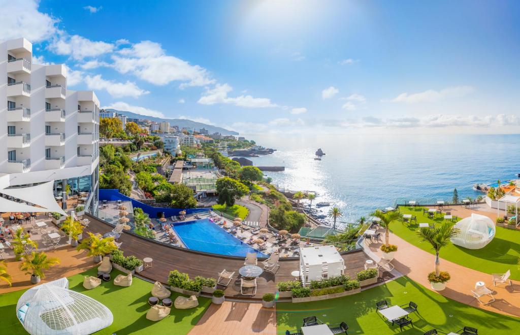
Funchal is the most convenient choice if you don’t rent a car, because most tours pick you up here. We stayed at Hotel Baía Azul in Funchal ourselves.
Want to sleep close to the mountains? Then Santana on the north coast is a good base for the PR1 (you finish nearby, in Achada do Teixeira), the PR9 and the Levada do Rei. For the PR6 and the Fanal forest, you’re better off in the west, around Calheta or Ponta do Sol.